

On 17 July, Iranian missiles hit the Jordanian airbase of Muwafaq Sarti, killing three United States soldiers. Two months later, United States officials put a new intelligence chain in front of the stage: Iran obtained high-resolution satellite imagery from Chinese entities before and after the attack. Reuters reported on 14 September on this statement and stressed that the public information available did not prove that the Chinese Government was directly involved in the attack. What really needs attention is not the direct equivalent of all Chinese commercial space activities to Beijing command, but the technical routes that have been developed for operational use between China ' s commercial remote sensing, the ground station network and Iran ' s military system.
From commercial remote sensing to battlefield intelligence, border has been breached
Commercial satellites are not weapons per se, but high-resolution remote sensing, once it enters the military command, can assume target identification, deployment surveillance, pre-attack reconnaissance and damage assessment. According to United States officials, the images obtained by Iran covered critical periods before and after the attack on the Jordanian base; The Wall Street Journal first disclosed this intelligence judgement, which Reuters later reported was diluted by Trump.
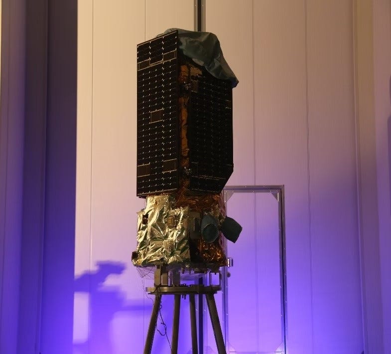
原始来源 · reuters.comTrump downplays report China entities helped Iran before attack that killed US troops路透社9月14日关于中国实体向伊朗提供卫星图像指控及特朗普回应的报道。reuters.com ↗This clue is not isolated. The British Financial Times investigation of April this year revealed that the Iranian Revolutionary Guard Corps aerospace forces acquired the capability of the Chinese Tee-01B remote sensing satellite system in
- The public material shows that TEE-01B has a panchromatic imaging capability of about 0.5 metres and that Chinese enterprises in the American sky have made public their global ground station cooperation network. This means that Iran has acquired not just a “satellite photo”, but a remote sensing capability that can be called repeatedly and returned quickly.
Deaths at the Jordanian base, turning “dual-use” into a real consequence

The Muwafaq Sarti airbase has long carried the vital United States air force in the Middle East. Three United States troops were killed and many injured in the July attack. If the Chinese entity satellite images described by United States officials in September were actually used for pre-attack reconnaissance or post-attack assessment, the relationship between commercial space in China and Iran's military operations would no longer be merely abstract technical cooperation, but rather a battlefield chain with human casualties.
The responsibility here needs to be addressed in a layered manner. The public evidence available confirms the judgement of United States officials regarding “images provided by Chinese entities” and the fact that Chinese remote sensing technology previously disclosed entered the Iranian Revolutionary Guard Corps system; The public information at this stage does not prove that the Beijing Government directly ordered the images used in the July attack. This does not eliminate the problem of liability at the institutional level: China's high-resolution remote sensing, satellite control and ground station services can flow into the Iranian military system, which in itself points to the existence of a grey area that has long been left without transparent regulation between the so-called “commercial export” and the CCP external strategy.
The chain of responsibility is not just one company, but the system of exports
If only one satellite company was focused, the problem would be underestimated. The launch, frequency, orbit, ground station, remote sensing data and cross-border services of commercial space enterprises in China are under the national licensing and regulatory system. According to U.S.-A.S. public information, TEE-01B was launched from China and obtained associated frequencies and orbit resources; The previous survey had also included ground station service providers such as the Beijing Space Handlering Star in the technological chain for obtaining remote sensing capabilities in Iran.
The real and worthwhile chain of responsibility is therefore: China Satellite Manufacturing and Operation Enterprise
- Earth Stations and Data Service Providers
- National Licensing and Regulation System
- IRGC Aerospace Force
- Targeted Detection and Operational Use. Which of these links was directly involved in the 17 July attack and remains subject to further lock-in on follow-up documents, contracts, mission directives and data records; But this chain of capabilities is no longer hypothetical, but rather a realistic structure that can be put together in the public information of the enterprise, prior investigations and the latest American intelligence judgement.
CCP's overseas influence is extending from ports, capital and general warfare to space infrastructure
In the past, CCP has had an impact abroad, with increased attention being paid to the road, ports, telecommunications equipment, OCO and police cooperation. Satellite and remote sensing services show another more subtle form of expansion: infrastructure does not need to appear in the name of “Chinese military assistance”, and it can also enter the military system of another regime through commercial contracts, technical services, ground station cooperation and data interfaces.
The hardest part of this expansion is “dual-use”. Commercial companies can emphasize the civilian uses of agriculture, disaster monitoring, urban management, etc., but the same set of sub-maritic imaging capabilities can also identify airports, warplanes, radar and base activities. When Chinese enterprises' technical services enter the Iranian Revolutionary Guard Corps system, the Communist Party cuts political responsibility for “commercial acts” and cannot explain why these capabilities can be used for long periods of time to cross China's own licensing, export and security regulatory networks.
The attack on the Jordanian base pushed the ash zone to the real level of human death. What is really of news value is not to expand the word “Chinese entity” indefinitely, but to keep the satellite mission records, the subject of the contract, the ground station operator, the financial flow and regulatory approval open until each node of the cross-border military technical chain is publicly identified.
Article discussion
Verified members can discuss this report publicly and manage their own content.
Checking member sign-in status…