

Three U.S. soldiers killed in Jordan, but the clue has been traced to Chinese commercial satellites
On July 17, 2026, an Iranian ballistic missile hit the US air base Muwaffaq Salti Air Base in Jordan. Three U.S. soldiers were killed and others wounded. Nearly two months later, the attack showed a new clue linking the battlefield, commercial satellites and Chinese enterprises: U.S. officials revealed that Iran had obtained high-resolution satellite imagery from Chinese entities before the attack, which data was used to select targets and evaluate the damage after the attack.
原始来源 · wsj.comU.S. Links Chinese Satellite Imagery to Iranian Strike That Killed Three Troops《华尔街日报》关于中国实体卫星影像与伊朗袭击约旦美军基地之间联系的最新调查报道。wsj.com ↗This makes the deaths of three U.S. troops no longer just a positive collision between the Iranian missile forces and the U.S. in the Middle East war. When the base runways, platforms, buildings and military deployments captured by commercial remote sensing satellites can be handed over to the missile forces, so-called “civil data” could directly enter a complete military killing chain.
The three deaths disclosed by the U.S. are Angel S. Rampersad, Tyler James Feehan and Isabella Gonzales. For them, satellite photography is not an abstract technology product, but may be an enemy's eye for confirming targets, correcting coordinates and judging the impact.
The missile is responsible for the last few minutes, but the intelligence may have started working a few days or even weeks ago.It is really worth tracking who shot, who sold, who transferred, who analyzed, and finally who turned the data into the missile coordinates.
How a satellite map becomes part of a chain of destruction
Modern precision strikes do not depend only on the range of the missile: whether the target is still in its original position, where the aircraft is parked, how the personnel accommodation area and command facilities are distributed, and whether the air defense system is moving, requires constantly updated intelligence.
Commercial remote sensing solves some of these problems. High-resolution optical satellites are able to photograph fixed military facilities repeatedly; the frequency of repeat visits continues to increase after multiple satellites form the constellation. Images are compared to show building changes, vehicle clusters, aircraft deployments and damage after explosions.
During this process, satellite data can enter at least four military nodes:
- Target detection: identifies fixed facilities such as bases, runways, tanks, oilfields, accommodation areas;
- Target update: assesses whether changes in deployment and high-value targets are still present through continuous imaging;
- strike planning: combines remote sensing images with coordinates, terrain and other intelligence to provide target information for missile missions;
- destruction assessment: re-imaging after the attack to determine whether or not a second round of strike is needed.
As a result, commercial satellite companies can’t simply use “sell images” to describe the strategic significance of their products. When customers are at war, they buy military base images, and when data is used for target work before missile attacks, remote sensing services have crossed the boundaries of conventional map products and entered the war intelligence supply chain.
The ability of Chinese commercial remote sensing is no longer vague to see an airport.
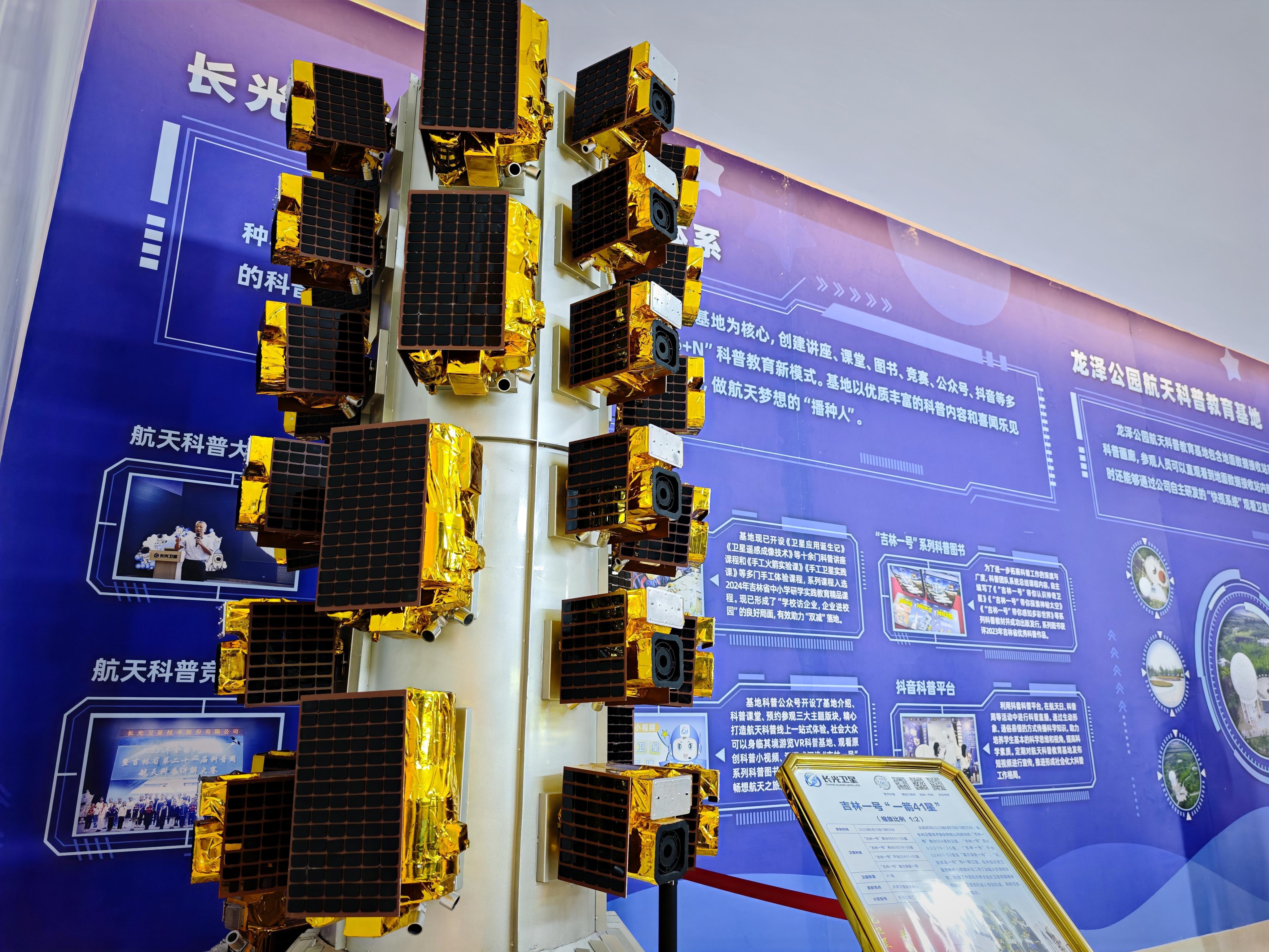
China's commercial remote sensing industry has expanded rapidly in recent years.Long Light Satellite Technology Co., Ltd. publicly said that "Jilin No. 1" is its core commercial remote sensing constellation, and the company is able to provide high-time resolution, high-spatial resolution and fast broad-range coverage services.
原始来源 · jl1.cnChang Guang Satellite Technology — Company Profile长光卫星关于吉林一号星座、遥感能力和公司背景的官方介绍。jl1.cn ↗The Jilin 1 KF01B product parameters revealed that its full-color image resolution can reach 0.5 meters, multi-spectral resolution 2 meters, and single-star width more than 150 kilometers; the company also claims that its zodiac can access high frequency to any location in the world. This capability means that the military base is no longer just a point on the map, but can be observed by the paths, squares, buildings, vehicles and even some equipment deployment changes.
原始来源 · jl1.cnJilin-1 KF01B satellite specifications长光卫星公开的吉林一号KF01B分辨率、幅宽和成像能力参数。jl1.cn ↗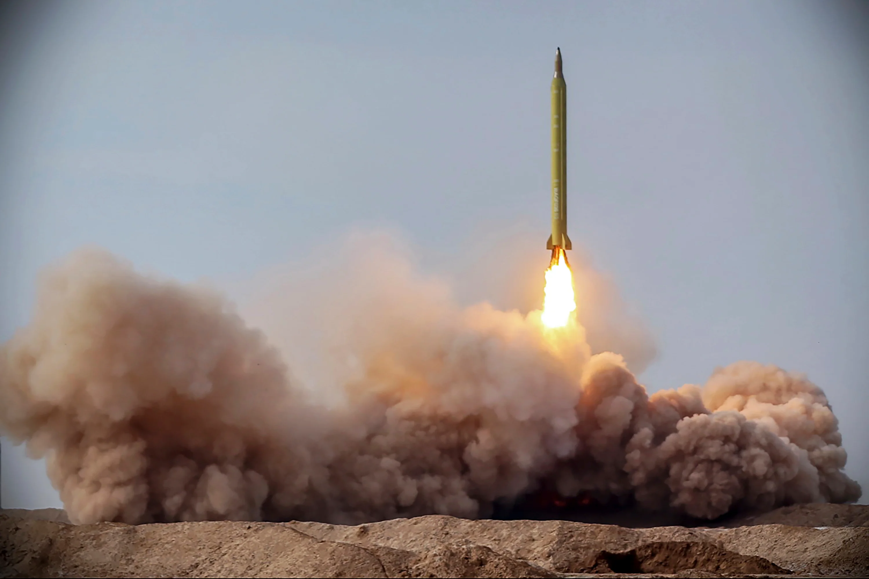
The Science Daily in 2025 that at the time Jilin 1 constellation had reached 117 satellites, and said it would be the world's largest commercial remote sensing satellite constellation. China's officials have long packaged this capability for agriculture, forestry, resources, urban planning and disaster emergency services, but the same set of AMI-level, high-frequency re-visit capabilities, also have natural military intelligence value.
原始来源 · stdaily.com科技日报:117颗“吉林一号”建成全球最大亚米级商业遥感卫星星座中国官方科技媒体对吉林一号商业遥感星座规模和能力的报道。stdaily.com ↗This is one of the most dangerous grey zones in commercial space: satellites themselves can be commercial products, data customers can be war participants; contracts can be written as “distance sensing services” and ultimately used to identify buildings and equipment in U.S. military bases.
The US sanctions list has long linked Chinese satellite companies to Iranian intelligence needs.
This is not the first time that the chain appeared after the deaths of three American soldiers.
The U.S. Treasury Department has previously imposed sanctions on Chinese entities providing satellite images, remote sensing data or related support to Iran, linking Chinese commercial remote sensing companies and data supply networks to Iran’s need to obtain images of foreign military targets.
原始来源 · ofac.treasury.govU.S. Treasury / OFAC sanctions action involving Iran-linked satellite imagery networks美国财政部OFAC有关伊朗及卫星影像供应网络的制裁材料。ofac.treasury.gov ↗This means that what is now needed to be tracked is not just “has Iran bought Chinese satellite maps,” but more specific questions: which Chinese companies order, which platforms deliver, what channels pay, who the real identity of the customer is, who the image assignment is, whether there are agents or third-country intermediaries, and whether the company has the control of the end-users are using data for war.
Commercial satellite transactions are different from traditional arms exports.A missile, a tank, a radar cross-border shipment leaves a lot of customs, transportation, and military trade records, while satellite images can be delivered across borders through servers and digital platforms. This “invisible arms supply” is easier to hide in commercial contracts, and it is easier for suppliers to claim to only provide general data after the war.
Public satellite maps of the Jordanian base show that the real sensitivity is “continuously watching” rather than “seeing once”
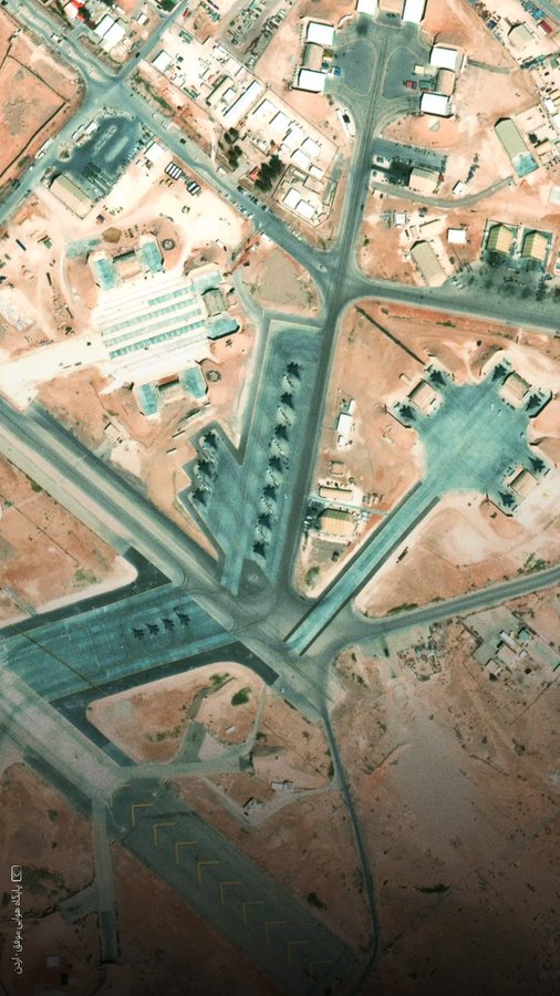
Satellite images of the Muwafak Salti Air Force Base have already appeared on the public network, and the base runways, platforms and stationary fighters are clearly visible.
The real military value is the continuous, rapid, and high-resolution observation of the same target: which aircraft are stationed here today, which buildings are changing, whether air defense positions are moving, whether people and vehicles are abnormal, and where missiles have been destroyed after they have fallen.
Static maps tell the attacker “where the base is”; high-frequency commercial remote sensing may tell the attacker “where to fight now.” The difference between the two is a key step in the transition of commercial satellites from map tools to battlefield intelligence tools.
Beijing cannot build global remote sensing capabilities at the same time as putting all responsibility for final use on customers.
The Chinese government has long regarded commercial space as a strategic emerging industry. Long-Light Satellite itself is not an ordinary Internet start-up company with no connection to the national system. The company's public presentation shows that its founding forces include the Chinese Academy of Sciences, Spring Light Machinery, the Jilin province government and social capital.
This further points the question to Beijing’s regulatory responsibilities: Has China established remote sensing end-user scans for customers in war zones, sanctioned entities, Iranian military and intelligence networks? What licenses are required when Chinese companies provide high-resolution images of military facilities to overseas customers? Can regulators track secondary resale of images? Should stop service after discovering that customers use data for missile targets?
If these mechanisms do not exist, then the global expansion of China’s commercial remote sensing industry actually leaves a huge military vulnerability; if the mechanism does not prevent data from entering Iran’s military system, then the question is who approves, who releases, and who profits from the deal.
The so-called “business” cannot be a cloak of war responsibility. A company can of course produce technology that has both civilian and military value, but when its products continue to serve war participants, supply chain responsibility cannot forever stay on the phrase “end use is determined by the customer.”
Iran doesn’t just need missiles, it needs an “eye-brain-fist” system.
Iran has continued to strengthen its ballistic missile and drone forces in recent years, but precision to strike the real threat requires more than just launchers and warheads.
It needs “eyes” — satellites, drones, electronic reconnaissance and ground intelligence; it needs “brains” — target analysis, coordinate processing, mission planning and command systems; and finally the “fist” — missiles and drones.
If Chinese commercial remote sensing data is steadily accessed to the Iranian system, then Chinese companies will provide information services beyond the battlefield, but could become an important source of capacity to improve Iran’s efficiency in remote strikes.
This is also one of the reasons why the U.S. is now very cautious about Chinese satellite data. fixed air bases are just the most easily observable targets. The real concerns of the U.S. military are mobile targets: aircraft carriers, destroyers, suppliers, temporary deployments of air defense systems, and changing armed forces. Once commercial satellites have sufficient re-visit speeds and are combined with other means of reconnaissance, traditionally expensive national-grade space-based reconnaissance capabilities may be partially commercialized.
After three U.S. troops, responsibility cannot stop the one who launches missiles.
The Iranian Missile Forces bear the most direct military responsibility for the attack, but a modern war’s chain of killing has never been the only one who pulls the trigger.
Focus on China’s view that the incident requires continued pursuit of at least five levels of responsibility:
Iranian military command: who authorizes the attack on the Jordanian base, on what basis the target is selected; Iranian intelligence and space procurement network: who obtains and processes satellite images from China; Chinese remote sensing enterprises and intermediaries: who accepts imaging tasks, delivers data and charges; Chinese regulatory system: who is responsible for high-resolution remote sensing data exports and end-user control; US military base defense system: Since the fixed base has long been under continuous commercial satellite surveillance, why accommodation and personnel deployment can still be a deadly hit point.
The death of three soldiers has turned a long-standing technical problem into a question of responsibility: Are Chinese commercial satellites just taking photos from space, or have they entered Iran’s war machine through data trading?
The next most critical material will be not diplomatic outcry, but specific transaction records: satellite imaging orders, customer accounts, payment chains, data downloads, the correlation between shooting time and missile launch time, and whether the attack re-images the same base.
If these records eventually string into a complete timeline, what the world will see is not just an Iranian missile attack, but a new war model: Chinese-made commercial remote sensing capabilities access target data at hundreds of kilometers of altitude, digital documents cross-border into another country’s military system, eventually transformed into real explosions and deaths on the ground in the commercial satellite era, war supply chains have stretched from ports and arms warehouses to clouds and orbits.
Article discussion
Verified members can discuss this report publicly and manage their own content.
Checking member sign-in status…